Please be aware of our copyright notice. If you have a good reaon for using a photo from this site ask permission from first - it is frequently given.
Meldon Viaduct
|
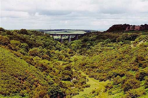
This photograph taken on a rare dry and sunny day for 2000 - 29th July to be exact - puts Meldon Viaduct's location into perspective being perched high and exposed on the north western edge of Dartmoor. This picture is taken from the south on Meldon Reservoir, a comparatively recent construction which opened just over 100 years after the original viaduct. The spindly wrought and cast iron trestle construction (some might describe as American looking) Meldon Viaduct was built by the LSWR under the direction of their Consulting Engineer W R Galbraith for the opening of the line between Okehampton and Lydford on the 12th October 1874. It spans the West Okement valley as the line makes it way high around the north western edge of Dartmoor . This structure is in stark contrast to many of the solid and ugly bridges the LSWR built elsewhere, for instance across the Thames in several places. Its maximum height above the valley is 150ft with a rising gradient of 1 in 77 towards the west on a 30 chain radius curve. The original viaduct was built for single track but in 1878 the line was doubled by building a second similar viaduct on the down side. The two viaducts were linked by extending the deck construction and bracing between the tops of the trestles, however the lower ends of the trestles were only interlaced. However the exposed position during adverse weather and the forces exerted on the structure by trains traversing the bend resulted in speed and weight restrictions being imposed.. In 1938 braces were added between the lower ends of the trestles then in 1944 to allow heavy wartime traffic across the viaduct the outer trestle legs were weighted with additional concrete. The viaduct was further strengthened between 1959 and 1960 by the inner trestle legs also being weighted and the up road trestle bracing being replaced with stronger section members. The line was singled between Meldon Quarry and Meldon Junction signal boxes (junction for North Cornwall line to Halwill thence Bude/Padstow/Barnstaple) on the 24th April 1966 and thereafter trains used the recently strengthened original up trestle. When services west of Okehampton were withdrawn on the 6th May 1968 the track on the bridge was for very many years (at least as late as the middle 1980s) used as a locomotive headshunt for the adjacent Meldon Quarry. The down side of the viaduct had a concrete road laid upon it in 1970 and this was used for construction traffic whilst the nearby Meldon Reservoir was built. The track was lifted in 1990 when the structured was judged to be too weak to support the weight of a train. In 1996 the viaduct was refurbished for its new use as part of the Dartmoor Way footpath and the Devon Coast to Coast Cycle Route so today it can be traversed by foot and cycle. It is also accessible from the "Dartmoor Pony" train service from Okehampton Station. Alternatively it can be walked underneath along a farm track from the village of Meldon or via a steep but otherwise reasonably short hike down from the Meldon Reservoir (which has a public car park and conveniences).
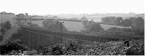
The viaduct whilst still in service with British Railways in the 1960s. Meldon Junction is just beyond the overbridge. photograph by Alan Robinson
The southern/down side of the viaduct from closer. photograph by Colin Duff
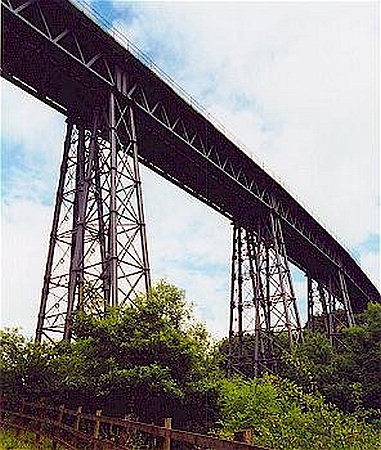
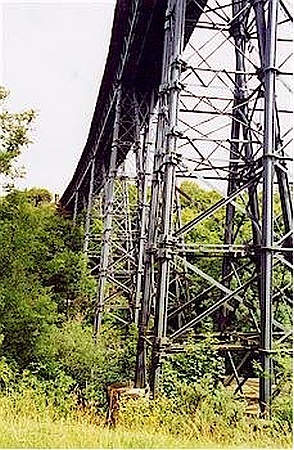
The interlaced trestle legs only become apparent from comparatively close up. photograph by Colin Duff
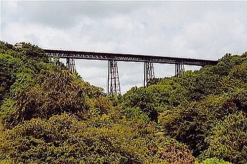
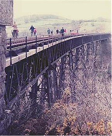
The up/northern side of the viaduct from the west in February 1999. photograph by Jonathan Hall
The underside! photograph by Jonathan Hall
A view of the up/northern side of the viaduct taken from the east in 1983 when the quarry headshunt was still in use with the track seen on the up side deck. photograph by Colin Duff
The trestle legs from the north west. photograph by Colin Duff
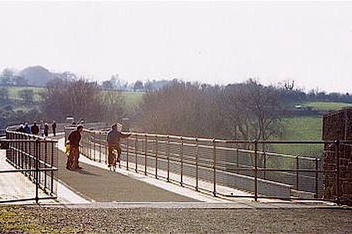
The deck of the viaduct is now a cycle trail and footpath, as seen in the low winter sun on 17th February 2001. photograph by Colin Duff
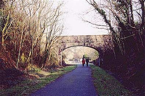
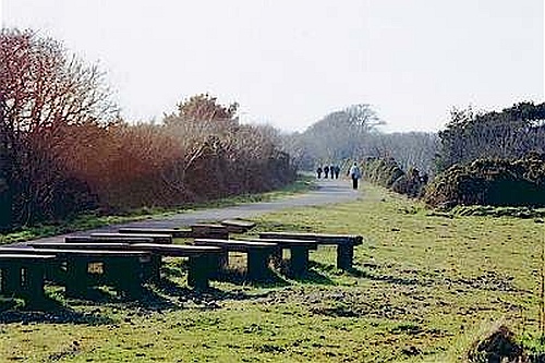
In the western direction the trail continues uphill towards Meldon Junction passing under a bridge and into a cutting which is today considerably overgrown compared to how it would have been in rail days. This photograph is looking east back towards the viaduct. photograph by Colin Duff
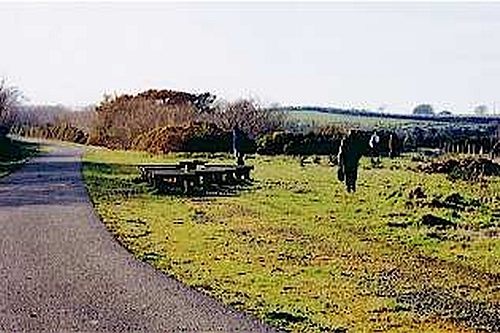
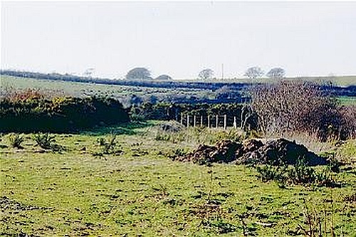
Further up the trail is the site of Meldon Junction with...... photograph by Colin Duff
.....on the left the former route to Plymouth via Tavistock Bere Alston and Devonport...... photograph by Colin Duff
.....and on the right "over the hills and far away" the former route to the extremes of the "withered arm" - Bodmin, Bude and Padstow via Halwill. photograph by Colin Duff |


This page was last updated 3 December 2002
![]()